


| البداية |
1552 (غريغوري) |
|---|---|
| الاسم الرسمي |
Temeşvar Eyaleti (بالتركية) |
| الاسم الأصل |
Temeşvar Eyaleti (بالتركية) |
| البلد | |
| العاصمة | |
| الإحداثيات | |
| حل محله | |
| حلَّ محل | |
| تاريخ الحل أو الإلغاء أو الهدم |
1716 |
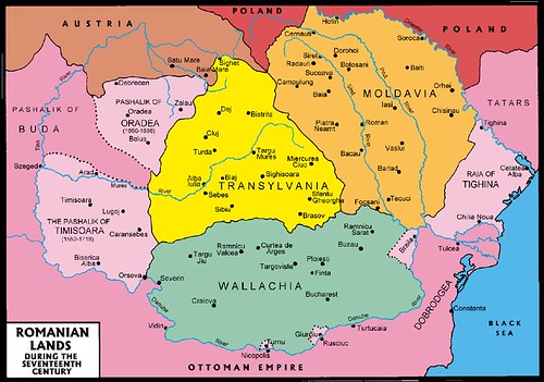
إيالة طمشوار (التركية العثمانية: ;ایالت طمشوار؛ بالتركية الحديثة: Eyālet-i Tımışvār)[1] كانت وحدة إدارية من المستوى الأول (إيالة) في الإمبراطورية العثمانية. كانت موجودة من عام 1552 إلى عام 1716. كانت الإدارة الإقليمية متمركزة في طمشوار ( تيميشورا اليوم) من عام 1552 إلى عام 1659، ومرة أخرى من عام 1693 إلى عام 1716. خلال الفترة من 1659 إلى 1693، كانت عاصمتها الثانية هي يانوفا (إنيو [الإنجليزية] اليوم)، وخلال تلك الفترة، كانت تُعرف أيضًا باسم مقاطعة يانوفا. كانت المقاطعة تقع في منطقة بانات في أوروبا الوسطى. بالإضافة إلى بانات، شملت أيضًا الأجزاء الجنوبية من منطقة كريشانا [الإنجليزية]، شمال نهر موريش. أصبحت أراضيها الآن مقسمة بين المجر ورومانيا وصربيا.[2][3][4]
التركيبة السكانية
استوطن العديد من المسلمين البلقان في المنطقة، وكانوا يعيشون في الغالب في المدن ويرتبطون بالتجارة والإدارة. كانت منطقة بانات مأهولة بشكل رئيس بالراسين [الإنجليزية] (الصرب) في الغرب،[5] والفلاش [الإنجليزية] (الرومانيين) في الشرق. وهكذا، في بعض المصادر التاريخية، أُشير إلى منطقة بانات باسم راسيا، بينما أُشير إليها في مصادر أخرى باسم والاشيا.[5]
طالع أيضًا
مراجع
- ^ "Some Provinces of the Ottoman Empire". Geonames.de. اطلع عليه بتاريخ 2013-02-25.
- ^ Dávid 1994، صفحة 143–162.
- ^ Dávid 1999، صفحة 113–128.
- ^ Kolçak 2020، صفحة 69–86.
- ^ ا ب Pálffy 2021، صفحة 85.
مصادر
- Dabić، Vojin S. (2011). "The Habsburg-Ottoman War of 1716–1718 and Demographic Changes in the War-Afflicted Territories". The Peace of Passarowitz, 1718. West Lafayette: Purdue University Press. ص. 191–208.
- Dávid، Géza؛ Fodor، Pál، المحررون (1994). Hungarian-Ottoman Military and Diplomatic Relations in the Age of Süleyman the Magnificent. Budapest: Loránd Eötvös University, Hungarian Academy of Sciences, Institute of History. مؤرشف من الأصل في 2023-04-18.
- Dávid، Géza (1994). "The Sancakbegis of Arad and Gyula". Acta Orientalia Academiae Scientiarum Hungaricae. ج. 46 ع. 1992–1993: 143–162. مؤرشف من الأصل في 2024-05-16.
- Dávid، Géza (1999). "The Eyalet of temesvár in the Eighteenth Century". Oriente Moderno. ج. 79 ع. 18: 113–128. مؤرشف من الأصل في 2024-11-14.
- Dávid، Géza (2000). "An Ottoman Military Career on the Hungarian Borders: Kasim Voyvoda, Bey, and Pasha". Ottomans, Hungarians, and Habsburgs in Central Europe: The Military Confines in the Era of Ottoman Conquest. Leden-Boston-Köln: Brill. ص. 265–297.
- Fodor، Pál (1999). "Who should obtain the castle of Pankota (1565)? Interest groups and self-promotion in the mid-sixteenth-century Ottoman political establishment". Turcica. ج. 31: 67–86. مؤرشف من الأصل في 2024-08-19.
- Káldy-Nagy، Gyula (2000). A csanádi szandzsák 1567. és 1579. évi összeírása. Szeged: Csongrád Megyei Levéltár. مؤرشف من الأصل في 2024-02-19.
- Kılıç، Orhan (1997). 18. Yüzyılın İlk Yarısında Osmanlı Devleti'nin İdari Taksimatı: Eyalet ve Sancak Tevcihatı. Elazığ: Şark Pazarlama. مؤرشف من الأصل في 2024-07-10.
- Kolçak، Özgür (2020). "Köprülü enterprises in Yanova ([Boros]Jenő/Ineu) and Varad ([Nagy]Várad/Oradea): Consolidating Ottoman power and accumulating family wealth (1657–1664)". Archivum Ottomanicum. ج. 37: 69–86.
قراءة إضافية
- Gavrilović، Slavko (1993). "Serbs in Hungary, Slavonia and Croatia in struggles against the Turks (15th–18th centuries)". Serbs in European Civilization. Belgrade: Nova, Serbian Academy of Sciences and Arts, Institute for Balkan Studies. ص. 41–54.
- Hegyi، Klára (2000). "The Ottoman Network of Fortresses in Hungary". Ottomans, Hungarians, and Habsburgs in Central Europe: The Military Confines in the Era of Ottoman Conquest. Leden-Boston-Köln: Brill. ص. 163–193.